Skip to content
Search
Menu

These bookings go through Viator, and we are paid for them. Your price is the same, and the payment had nothing to do with the picks.

Rows of boats moored in a marina basin on flat water in early morning light
Kevin Stephenson from Florence, AL, USA

Neighbourhood

Orange Beach

Last updated

Alabama's other beach city: nine thousand people, a maze of back bays and the only cut from those bays to open Gulf water.

Alabama has roughly thirty-two miles of coast and two towns on it, and people arriving for the first time assume Orange Beach is the eastern end of Gulf Shores. It is not. It is a separate incorporated city of around nine thousand residents with its own council, its own police department, its own beach ordinances and its own parking rules, and the practical consequence is that a pass or a permit bought in one town is worth nothing in the other.

The difference that actually shapes a holiday is water. Gulf Shores is organised around a highway that runs down to the sand. Orange Beach is organised around a tangle of protected back water behind it: Terry Cove, Cotton Bayou, Wolf Bay, Arnica Bay, Bay La Launch, Old River, Ingram and Roberts Bayous, all connected to the Intracoastal Waterway and, crucially, to the Gulf through the single cut at Perdido Pass. That is why the charter boats, the marinas, the boatyards and the dolphin cruises are concentrated here rather than four miles west. If your week involves getting on a boat, you will be driving east.

The name is older than any of it. Oranges were grown on this stretch and shipped out until hard freezes around 1916 finished the groves, and the settlement dates to the mid-1860s, when the western end was Orange Beach, the middle was Caswell and the eastern end was Bear Point. Those names survive locally in a way the citrus did not.

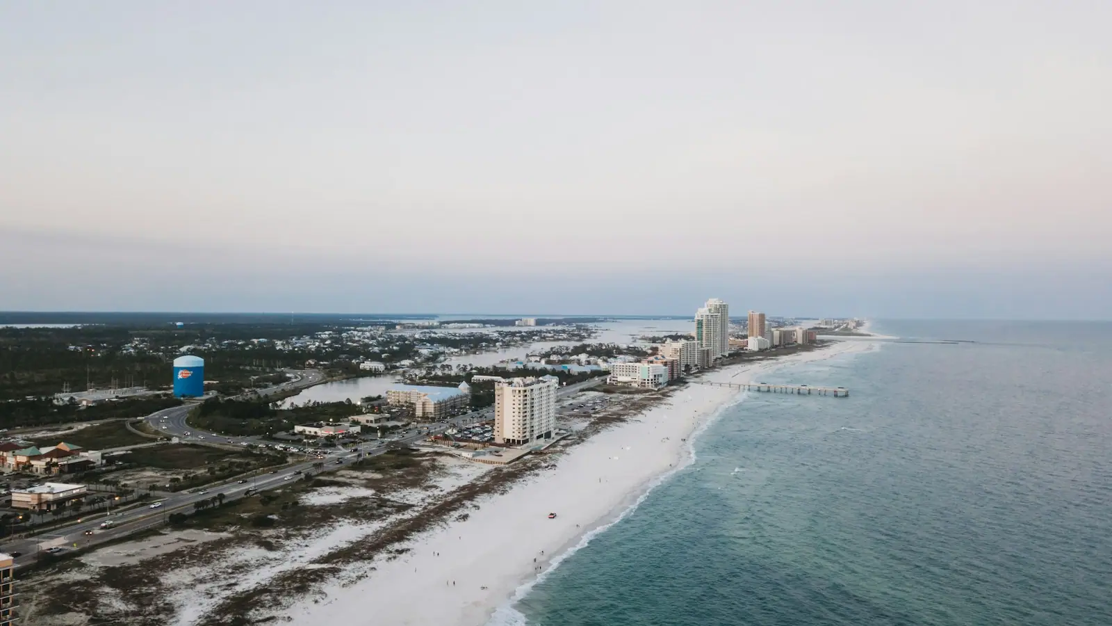
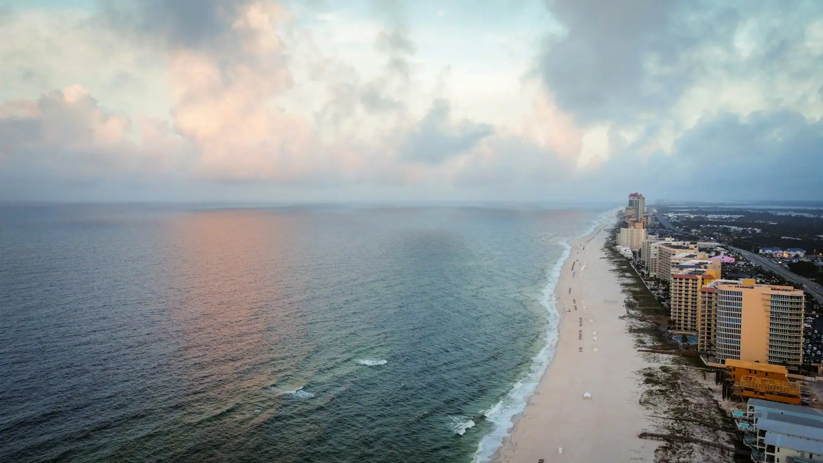
What a visitor sees today is a beachfront of towers along Perdido Beach Boulevard, a working marina district behind them, and The Wharf inland on the waterway. It is quieter on the sand than Gulf Shores, busier on the water, and more expensive in most weeks of the year.

Getting there and parking

From Gulf Shores, either take Perdido Beach Boulevard (Highway 182) east along the coast, which is scenic and slow in season, or run Canal Road (Highway 180) inland and drop south on Highway 161, which is usually faster on a summer afternoon.

From Pensacola the approach is west along Perdido Key and over the Perdido Pass bridge, roughly an hour outside traffic. From Mobile allow about an hour and three quarters via I-10 and Highway 59, then east.

The nearest commercial airports are Pensacola and Mobile, with Destin-Fort Walton Beach a longer option east. There is no rail and no scheduled public transport worth planning around; a car is effectively required.

Within the city, the marinas cluster behind the beach road and along Canal Road, and The Wharf sits on the Intracoastal Waterway inland. The Backcountry Trail reaches the western side of the city from Gulf State Park, which is the only realistic car-free connection between the two towns.

Why all the boats are here

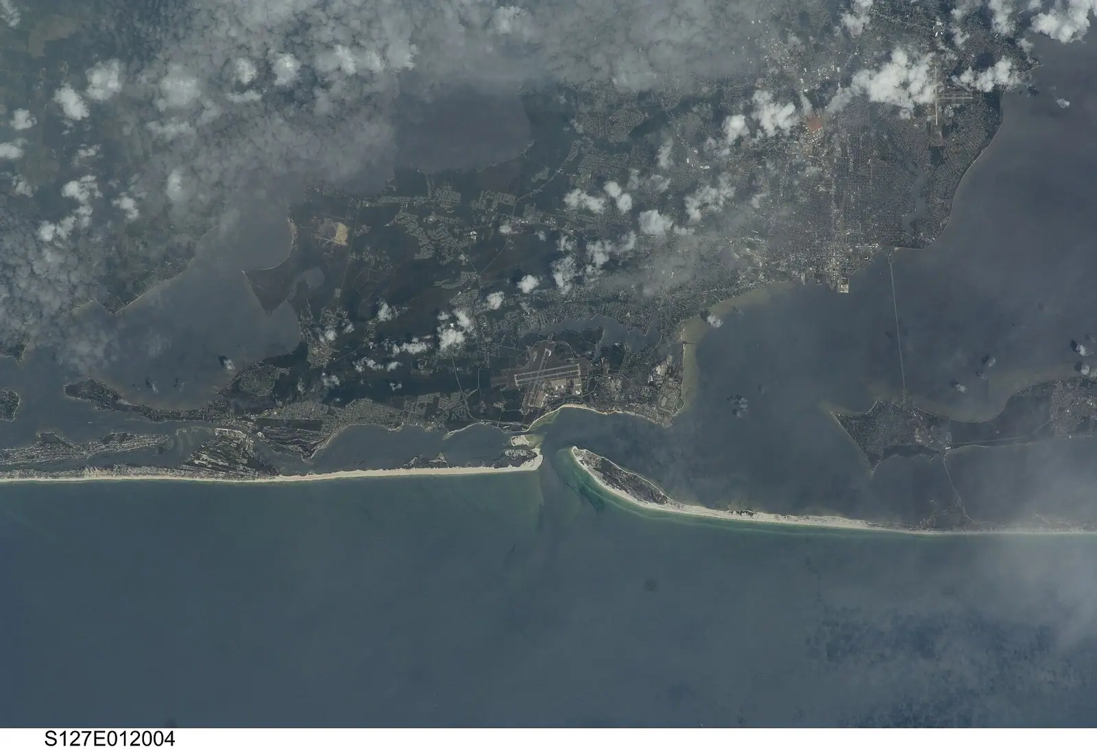
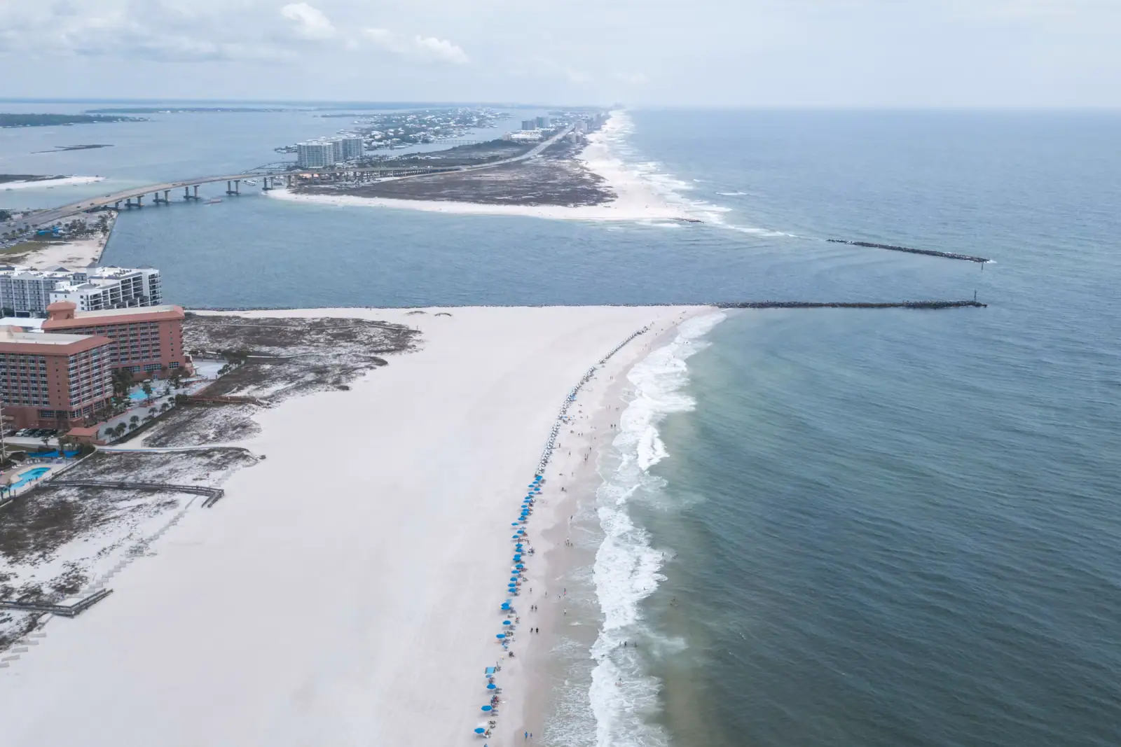
Look at the coastline from above and the logic is immediate. Behind the beach, a system of bays, bayous and coves runs inland for miles, sheltered from Gulf weather by the barrier strip and connected to each other and to the Intracoastal Waterway. Then there is one gap in the barrier: Perdido Pass. Everything that wants to move between protected water and open sea goes through it.

That single piece of geography built the local economy. Deep sheltered water for docks, an armoured channel out, and a Gulf that shelves into serious fishing ground within an hour's run. Orange Beach marinas carry a large offshore charter fleet as a result, alongside inshore guides working the bays, dolphin cruise boats, sailing charters and rental operators.

For a visitor, the useful distinction is inshore against offshore. Inshore trips stay in the bays and bayous: calm water, short runs, redfish and speckled trout, and the right choice for young children or anyone who gets seasick. Offshore means through the pass and out, with the red snapper season as the headline event of the Alabama fishing calendar and a boat ride that is genuinely rough on a windy day.

The back bays are also the quiet half of the destination. A kayak on Ingram Bayou at seven in the morning, with cypress along the bank and nothing moving, does not feel like the same place as the beach road at noon.

Orange Beach or Gulf Shores

Gulf ShoresOrange Beach
ArrivalHighway 59 runs straight to the sandHighway 161 or Canal Road, then along the beach road
Beach feelBusier, more day visitors, a public beach with musicQuieter sand, mostly tower frontage, fewer walk-up crowds
Water accessLittle Lagoon behind West Beach; no Gulf cutBack bays, marinas and Perdido Pass
BoatsSome operatorsThe fleet, the charters, the dolphin cruises
EveningThe Hangout, beach-front bars, the state parkThe Wharf, the marinas, the Flora-Bama further east
ParkingCity hourly charging since July 2026City rules, plus separate state park accesses in town

Neither is better. They answer different weeks.

Choose Gulf Shores if you want to walk to the beach from a rental, want the public facilities, are travelling with a car full of children and intend to spend most of the week on sand.

Choose Orange Beach if the point of the trip is fishing, boating, paddling the bays or a dolphin cruise, or if you want a quieter beach and do not mind driving to a supermarket.

Most people who come every year end up with a strong opinion and cannot explain it to anyone who does not.

Two towns, two rulebooks

The single most common visitor mistake on this coast is assuming one set of rules covers thirty-two miles. It does not, and there are effectively three authorities operating on the same beach road.

Gulf Shores runs its own beach accesses and moved to hourly app-based parking for non-residents on 1 July 2026.

Orange Beach runs its own accesses and its own ordinances, with its own resident arrangements.

Gulf State Park runs several accesses that sit physically inside the Orange Beach city limits — Romar, Cotton Bayou, Alabama Point East — on the state's flat daily vehicle rate, with an annual permit sold only in person at park headquarters.

A pass from one does not work at another. Read the sign in front of the space rather than the one you remember from yesterday.

Beach rules follow the same pattern. Both cities fly the standard flag system and both treat the double red as a closure rather than advice, but the detail of ordinances, dog rules, tent and canopy restrictions and overnight equipment rules is set separately and revised. Anything you plan to leave on the sand overnight, anywhere on this coast, is likely to be removed.

Hurricane season runs from June to the end of November. Both cities operate re-entry decal systems for residents and property owners after a storm, which is the reason visitors see those stickers on every third windscreen.
Tours that visit Orange Beach

Operators run these trips past Orange Beach, or stop there as part of a longer route. We list what the booking data supports — not everything that mentions the name.

These bookings go through Viator, and we are paid for them. Your price is the same, and the payment had nothing to do with the picks.

Shared departurespriced per seat, best value for one or two

Private and small-group optionsoften cheaper per head for a family or a group of six

Near Orange Beach

Straight-line distances, so allow more on the road — the island is long and has one main parkway.

  • Aerial view of a narrow tidal pass cut between two low sandy shorelines
    Free
    Water feature

    Perdido Pass

    The only gap in thirty-two miles of Alabama barrier coast, armoured with granite, and the wrong place to let anyone swim.

    1–3 hoursFree to visit. Parking at the adjoining Gulf State Park beach accesses is charged per vehicle per day.1.2 mi away

  • An aerial view of a marina basin ringed by docks, moored boats and low waterfront buildings
    Free
    Shopping

    The Wharf

    A 220-acre marina and entertainment complex on the Intracoastal Waterway, with a 112-foot Ferris wheel and an amphitheatre behind it.

    1.5–5 hoursFree to walk around. The Ferris wheel, cinema, adventure attractions and concerts are all ticketed separately.2.7 mi away

  • Gentle surf running onto pale sand with turquoise water beyond
    Beach

    Romar Beach

    A state park beach access with an Orange Beach address, which means state parking rules, not city ones, and a 1920s name nobody explains.

    1.5–5 hoursFree to walk on. Parking is the Gulf State Park flat daily vehicle rate, recently around $15.1.3 mi away

  • Sea oats on a low dune with a strip of white sand and bright turquoise water behind
    Free
    Beach

    Cotton Bayou Beach

    The Orange Beach access at the foot of Highway 161, with dune boardwalks, a state-park pay kiosk and no view of the bayou it is named for.

    2–6 hoursFree to walk on. Parking is charged by Gulf State Park: fifteen dollars a day for a car in 2026, with an annual pass sold separately.0.6 mi away

Orange Beach: common questions

What is the difference between Gulf Shores and Orange Beach?

They are two separate cities sharing one coastline. Gulf Shores is organised around Highway 59 running down to a busy public beach with facilities and day visitors. Orange Beach is organised around its back bays and marinas, with the charter fleet, the dolphin cruises and the only cut to the Gulf at Perdido Pass. Beach parking, ordinances and resident passes are set separately by each city and do not transfer.

Why is it called Orange Beach?

Because oranges were grown here. Citrus was cultivated on this part of the Alabama coast and shipped out commercially until hard freezes around 1916 ended it. The settlement dates from the mid-1860s, and for a long time it was three places rather than one: Orange Beach at the western end, Caswell in the middle and Bear Point to the east. Those older names still turn up locally.

Is Orange Beach better than Gulf Shores for families?

It depends on what the week is for. Gulf Shores has the walkable public beach, the pavilions, the playground and the day-trip infrastructure, which suits families who plan to live on the sand. Orange Beach has the quieter beach, the calm back bays for paddling and inshore fishing, and the boats, which suits families whose children are old enough to want a dolphin cruise or a charter.

Do you need a car in Orange Beach?

Effectively yes. There is no scheduled public transport worth planning a holiday around, the marinas are spread along Canal Road and behind the beach, and the supermarkets are inland. The one genuine exception is the Backcountry Trail, which connects the western side of the city to Gulf State Park and Gulf Shores on paved, flat, car-free miles and is often faster than driving in August.